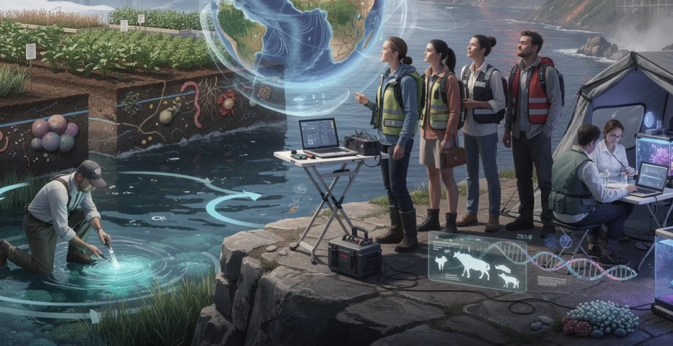
The interconnected challenges facing humanity in the 21st century—from accelerating climate disruption to emerging infectious diseases—demand a deep understanding of the complex systems that sustain life on our planet. Life and earth sciences provide the foundational knowledge and analytical tools necessary to address these existential threats. As global temperatures continue their upward trajectory and ecosystems experience unprecedented stress, scientists trained in biogeochemistry, ecology, geology, and related disciplines are positioned at the forefront of developing evidence-based solutions. The integration of traditional field research with cutting-edge technologies like genomic sequencing, satellite remote sensing, and artificial intelligence has transformed these disciplines into dynamic, solution-oriented fields. For students considering their academic pathways, few areas of study offer such immediate relevance to the most pressing concerns of our era whilst simultaneously providing diverse and fulfilling career opportunities.
The scope of life and earth sciences has expanded dramatically beyond traditional boundaries. Modern practitioners engage with disciplines ranging from molecular biology to planetary geology, often working in interdisciplinary teams that bridge the natural and computational sciences. This breadth creates remarkable flexibility for those entering these fields, allowing specialisation in areas as diverse as astrobiology, conservation genomics, or volcanic hazard assessment. Universities worldwide have responded to this evolution by developing programmes that emphasise systems thinking and provide students with both theoretical knowledge and practical skills applicable to real-world environmental challenges.
Climate change mitigation through biogeochemical cycle research
Understanding the intricate pathways through which carbon, nitrogen, phosphorus, and other elements cycle through Earth’s atmosphere, oceans, and terrestrial ecosystems represents one of the most critical areas of contemporary earth science research. These biogeochemical processes regulate planetary climate on timescales ranging from seasons to millennia, and human activities have fundamentally altered their natural rhythms. Scientists studying these cycles work to quantify the sources and sinks of greenhouse gases, model future climate scenarios, and identify potential intervention strategies that could slow or reverse atmospheric warming. The complexity of these systems means that research in this area requires expertise spanning chemistry, biology, physics, and mathematics—making it an intellectually stimulating field for those who enjoy integrating knowledge across disciplinary boundaries.
Carbon sequestration mechanisms in marine ecosystems
The world’s oceans absorb approximately 25% of anthropogenic carbon dioxide emissions annually, functioning as Earth’s largest active carbon sink. Marine scientists investigate the biological pump—the process whereby phytoplankton photosynthesise carbon at the surface, which then sinks to deep waters as organisms die and decompose. Researchers are exploring whether enhancing this natural process through ocean iron fertilisation or cultivating macroalgae could provide a scalable climate mitigation strategy. Recent studies have demonstrated that mangrove forests, seagrass meadows, and salt marshes sequester carbon at rates per unit area far exceeding terrestrial forests, leading to increased conservation efforts for these “blue carbon” ecosystems. Understanding the mechanisms controlling carbon storage in marine sediments requires knowledge of microbial ecology, ocean chemistry, and sediment dynamics—skills that earth science programmes specifically develop.
Nitrogen fixation dynamics and agricultural sustainability
The Haber-Bosch process, which converts atmospheric nitrogen into ammonia for fertiliser production, consumes roughly 2% of global energy supplies and has enabled food production for billions of people. However, excess reactive nitrogen from agricultural runoff creates dead zones in coastal waters and contributes to greenhouse gas emissions in the form of nitrous oxide, a compound with nearly 300 times the warming potential of carbon dioxide. Scientists studying the nitrogen cycle investigate biological nitrogen fixation by legumes and soil bacteria, seeking to reduce dependence on synthetic fertilisers. Recent advances in genomic engineering have raised the possibility of introducing nitrogen-fixing capabilities into staple crops like wheat and rice, potentially revolutionising agricultural sustainability. This research requires understanding soil biogeochemistry, plant physiology, and microbial genetics—a truly interdisciplinary endeavour characteristic of modern life sciences.
Methane flux modelling in permafrost regions
Arctic permafrost contains an estimated 1,600 billion tonnes of carbon—nearly twice the amount currently in Earth’s atmosphere. As global temperatures rise, permafrost thawing accelerates, releasing methane and carbon dioxide through microbial decomposition of previously frozen organic matter. This creates a potentially catastrophic feedback loop
that climate models must capture accurately to predict future warming. Researchers in life and earth sciences combine field measurements of methane bubbles in lakes, eddy-covariance towers over tundra, and satellite observations of surface thaw with numerical models to estimate current and future methane emissions. You might work with high-resolution climate data, remote sensing imagery, and Earth system models to understand how different warming scenarios affect permafrost stability. For students interested in climate change mitigation, this field offers the chance to directly inform international policy discussions on carbon budgets and tipping points.
Ocean acidification impact on carbonate chemistry
As the oceans absorb more carbon dioxide, they become more acidic, altering seawater carbonate chemistry and threatening organisms that build shells and skeletons from calcium carbonate. Ocean acidification research in life and earth sciences examines how changing pH affects coral reefs, plankton, and shellfish, as well as the overall marine carbon cycle. By conducting controlled experiments, deploying autonomous sensors, and analysing long-term time series, scientists can determine thresholds beyond which ecosystems may not recover. This work is essential for designing marine protected areas, forecasting fisheries impacts, and evaluating whether negative emissions technologies could unintentionally exacerbate local acidification.
Studying ocean carbonate chemistry requires a solid grounding in chemistry, oceanography, and marine ecology, but it also demands creativity in experimental design. You might help develop new sensors that can monitor pH and alkalinity in remote regions, or contribute to models that simulate how future emissions pathways will alter ocean chemistry. Understanding these processes is like learning the “financial accounting” of the ocean’s carbon bank: without precise bookkeeping, we cannot know how much climate debt we are accruing. Students who specialise in this area gain highly transferable skills in data analysis, instrumentation, and environmental modelling.
Biodiversity crisis and conservation genomics applications
Parallel to climate change, a global biodiversity crisis is unfolding, with extinction rates estimated to be tens to hundreds of times higher than natural background levels. Life sciences and earth sciences together provide the tools to document, understand, and potentially reverse these losses through conservation genomics, landscape ecology, and ecosystem modelling. Conservation genomics uses high-throughput DNA sequencing to assess genetic diversity, identify inbreeding, and detect adaptive variants that might help species cope with rapid environmental change. When combined with spatial data from remote sensing and geological mapping, these insights guide the design of protected areas and ecological corridors that maintain evolutionary potential.
Working in conservation genomics places you at the intersection of fundamental biology and applied conservation policy. You might sequence genomes of endangered species, analyse population structure across fragmented landscapes, or advise on breeding programmes that preserve critical genetic variation. As governments negotiate ambitious targets under frameworks like the Global Biodiversity Framework, demand is growing for scientists who can translate complex genomic data into practical conservation strategies. If you are motivated by tangible biodiversity protection, this is one of the most impactful ways to apply life and earth sciences today.
Crispr-based de-extinction projects for woolly mammoth restoration
Among the most high-profile conservation genomics initiatives are CRISPR-based de-extinction projects, such as efforts to recreate woolly mammoth-like elephants adapted to Arctic environments. While genuine “resurrection” of extinct species remains controversial and technically challenging, genome editing allows researchers to introduce key traits—like cold tolerance—into closely related species. This work involves sequencing ancient DNA preserved in permafrost, comparing it to modern elephant genomes, and using CRISPR-Cas9 tools to edit embryos in ways that could produce animals capable of thriving in tundra ecosystems. Advocates argue that such organisms could help restore grassland ecosystems and alter surface reflectivity, potentially contributing to climate regulation.
Beyond the headlines, de-extinction research forces us to wrestle with ethical, ecological, and practical questions. Should resources go toward reviving lost species, or prioritise those currently at risk? Could introducing mammoth-like elephants disrupt existing Arctic ecosystems or Indigenous livelihoods? For students, these debates illustrate how scientific capability in life and earth sciences must be coupled with training in ethics, law, and social science. Even if you never work directly on de-extinction, understanding genome editing and ancient DNA analysis will be invaluable in many areas of conservation genomics and evolutionary biology.
Environmental DNA metabarcoding for species monitoring
Traditional biodiversity surveys often require time-consuming fieldwork and specialist taxonomic expertise, making it difficult to monitor species across large or inaccessible areas. Environmental DNA (eDNA) metabarcoding has transformed this landscape by allowing scientists to detect organisms from trace genetic material left in water, soil, or air. By filtering a litre of river water, extracting DNA, and sequencing standard genetic markers, researchers can identify dozens or even hundreds of species—from fish and amphibians to invasive mussels—without ever seeing the organisms themselves. This approach is revolutionising conservation monitoring, enabling earlier detection of invasive species and more accurate assessments of ecosystem health.
For students interested in combining molecular biology with field ecology, eDNA offers a powerful, hands-on research avenue. You might develop sampling protocols for urban wetlands, optimise bioinformatic pipelines that assign sequence reads to species, or work with policymakers to integrate eDNA results into environmental regulations. The method is a bit like forensic science for ecosystems: by reading the genetic “fingerprints” left behind, we can reconstruct who lives where and how communities change over time. As sequencing costs continue to fall, skills in eDNA metabarcoding and biodiversity informatics will be increasingly sought after in government agencies, NGOs, and environmental consultancies.
Population viability analysis in fragmented habitats
Habitat fragmentation—from roads and urban expansion to agricultural development—splits wildlife populations into smaller, isolated units that are more vulnerable to extinction. Population viability analysis (PVA) combines demographic data, genetic information, and landscape features to estimate the probability that a population will persist over specified time frames. Researchers in life and earth sciences build models that incorporate birth and death rates, dispersal barriers like mountains or rivers, and climate projections to test different management scenarios. For example, they might compare the benefits of installing wildlife crossings, expanding protected areas, or translocating individuals between reserves.
Learning PVA equips you with quantitative tools to support evidence-based conservation decisions. You will work with statistical software, spatial datasets, and sometimes even machine learning to explore how different pressures interact to influence extinction risk. These models are not crystal balls, but they act like sophisticated “flight simulators” for conservation, allowing managers to test interventions before implementing them on the ground. Students who enjoy applied mathematics and ecology often find PVA an engaging bridge between theoretical models and real-world conservation outcomes.
Coral reef microbiome engineering for bleaching resistance
Coral reefs are among the most biodiverse ecosystems on Earth, yet they are acutely vulnerable to marine heatwaves and ocean acidification. In addition to the symbiotic algae that live within coral tissues, corals host diverse microbial communities that influence their health and stress tolerance. Microbiome engineering aims to manipulate these microbial communities—by introducing beneficial bacteria or selecting for heat-tolerant symbionts—to enhance coral resilience to bleaching. Researchers conduct controlled experiments in aquaria, transplant engineered corals to test sites, and monitor changes in microbial composition using metagenomic sequencing.
This line of research illustrates how life and earth sciences can move from diagnosis to intervention in the face of climate change. You might work on isolating probiotic bacterial strains, modelling how engineered microbiomes spread across a reef, or assessing potential ecological risks such as unintended shifts in pathogen dynamics. The work requires a blend of marine ecology, microbiology, and bioinformatics, and it raises important questions: how far should we go in “assisting evolution” to preserve ecosystems under rapid environmental change? For students interested in climate adaptation and marine conservation, coral microbiome engineering offers a cutting-edge, highly interdisciplinary research pathway.
Pandemic preparedness through zoonotic disease surveillance
The COVID-19 pandemic underscored how diseases that originate in animals—zoonoses—can rapidly disrupt societies and economies worldwide. Life and earth sciences are central to pandemic preparedness because they illuminate how environmental change, wildlife ecology, and human behaviour drive spillover events. Deforestation, urbanisation, and climate-driven shifts in species ranges all alter contact patterns between wildlife, livestock, and people. By studying these dynamics across landscapes, researchers can identify hotspots where new pathogens are most likely to emerge and design surveillance systems to detect them early.
Pandemic preparedness in this context is not just about virology; it is also about geography, land-use change, and ecosystem health. You might analyse satellite data to map deforestation, conduct fieldwork to collect samples from wildlife, or build models that link climate anomalies to disease outbreaks. The goal is to move from reactive responses to proactive risk reduction—an area where interdisciplinary training in life and earth sciences gives you a distinct advantage.
Bat coronavirus ecology and spillover event prediction
Bats host an exceptional diversity of coronaviruses, many of which coexist with their hosts without causing disease. Understanding bat coronavirus ecology—how viruses circulate within bat populations, how bats use different habitats, and how environmental stress affects viral shedding—is crucial for predicting and preventing spillover. Researchers combine field surveys in caves and forests with GPS tracking, viral sequencing, and ecological modelling to build a picture of where and when high-risk interactions with humans are most likely. Land-use changes such as mining, agricultural expansion, or cave tourism can increase these interactions and thus spillover risk.
Studying bat-virus systems requires careful attention to biosafety and ethical engagement with local communities, as well as robust quantitative skills. You might help design risk maps that overlay bat species distributions with human activity, or use machine learning to infer which viral traits predict the potential to infect humans. Think of this research as building an “early warning system” for pandemics grounded in ecology rather than waiting for hospital admissions to rise. Students with interests in wildlife biology, virology, and spatial analysis will find this a fertile and societally important field.
One health approach integration in epidemiological studies
The One Health framework recognises that human health, animal health, and environmental health are fundamentally interconnected. Integrating One Health into epidemiological studies means examining how livestock management, wildlife conservation, water quality, and climate variability jointly affect disease dynamics. For example, changes in grazing practices might alter tick populations, which in turn influence Lyme disease risk in humans; or intensification of poultry farming could intersect with migratory bird routes to shape avian influenza outbreaks. Life and earth scientists collaborate with medical professionals, veterinarians, and social scientists to develop interventions that work across these domains.
As a student, working within a One Health paradigm trains you to think in systems rather than silos. You may contribute to projects that couple hydrological models with cholera incidence data, or that integrate remote sensing of vegetation with malaria transmission models. The analogy is like moving from studying individual instruments to conducting an entire orchestra: only by understanding how all the parts interact can we manage complex health risks. Employers in public health agencies, international organisations, and NGOs increasingly seek graduates who are comfortable navigating this integrated perspective.
Metagenomics for novel pathogen discovery in wildlife reservoirs
Traditional pathogen surveillance often targets known viruses or bacteria, leaving a vast “dark matter” of undescribed microbes in wildlife reservoirs. Metagenomics—sequencing all genetic material in a sample without prior assumptions—allows scientists to discover novel pathogens and characterise entire microbial communities at once. In wildlife disease ecology, researchers might collect faeces, blood, or environmental samples from species such as rodents, primates, or birds, then use high-throughput sequencing and bioinformatics to identify unfamiliar viral genomes. This approach can reveal potential threats before they spill over into humans or livestock.
Developing expertise in metagenomics places you at the forefront of pathogen discovery and microbial ecology. You will learn to handle large datasets, assemble genomes from short sequence reads, and apply statistical tools to distinguish harmless commensals from likely pathogens. The work is data-intensive but intellectually rewarding, akin to assembling thousands of jigsaw puzzles at once where the final picture is an updated map of Earth’s virosphere. Skills in metagenomic analysis are highly transferable, with applications ranging from wastewater surveillance for public health to microbiome research in agriculture.
Geohazard assessment using remote sensing technologies
Earthquakes, volcanic eruptions, landslides, and active faults pose significant risks to communities worldwide, especially as populations grow in hazard-prone regions. Geohazard assessment uses tools from earth sciences, such as seismology and structural geology, in combination with remote sensing technologies to monitor and model these risks over large areas. Satellite data, aerial imagery, and ground-based sensors allow scientists to detect subtle changes in the Earth’s surface that may precede disasters. By transforming these signals into hazard maps and early warning systems, geoscientists help reduce loss of life and inform resilient infrastructure design.
For students interested in both technology and the natural world, remote sensing-based geohazard assessment offers a compelling career path. You may work with synthetic aperture radar images, process LiDAR point clouds, or integrate drone surveys with field observations. The ability to “see” geological processes from space—watching mountains rise or volcanoes inflate—is one of the most visually striking and practically valuable outcomes of modern earth science.
Insar applications for volcanic deformation monitoring
Interferometric Synthetic Aperture Radar (InSAR) uses repeated satellite radar images to detect millimetre-scale ground deformation over wide areas, making it an ideal tool for monitoring active volcanoes. As magma moves within the crust, it can cause the surface to slowly bulge or subside, patterns that InSAR can reveal long before visible eruptions occur. Volcanologists analyse time series of InSAR data to identify inflating magma chambers, track lava flows, and estimate eruption probabilities, often combining these insights with seismic and gas measurements for a more complete picture.
Working with InSAR requires both physical insight and computational skills. You will learn how radar signals interact with rough terrain, how atmospheric noise can mimic deformation, and how to use specialised software to generate interferograms. It is a bit like using medical imaging for the Earth—non-invasively looking beneath the surface to diagnose potential problems. Graduates with experience in InSAR find opportunities in volcano observatories, space agencies, and private firms that monitor subsidence related to groundwater extraction or resource exploitation.
Seismic tomography in earthquake-prone subduction zones
Seismic tomography uses waves generated by earthquakes to image the internal structure of the Earth, much as medical CT scans use X-rays to image the human body. In subduction zones—where one tectonic plate dives beneath another—seismic tomography helps reveal the geometry of slabs, the distribution of partial melt, and zones of weakness that may host future large earthquakes. By deploying dense seismic networks on land and at sea, geophysicists collect data that can be inverted to create three-dimensional models of seismic velocity variations, which in turn inform seismic hazard assessments for megacities located near subduction margins.
Students drawn to physics and mathematics will find seismic tomography a rigorous yet fascinating area of study. You might work on developing inversion algorithms, testing how different plate geometries affect wave propagation, or integrating tomographic models with geodetic and geological data. This work underpins more accurate earthquake hazard maps and tsunami risk assessments, with direct implications for building codes and disaster preparedness. As computational power grows, tomographic models become more detailed, making this a rapidly evolving field where new discoveries are frequent.
Landslide susceptibility mapping with machine learning algorithms
Landslides are triggered by factors such as heavy rainfall, earthquakes, and human activities like road cutting or deforestation. Predicting exactly when and where a landslide will occur remains challenging, but landslide susceptibility mapping can identify areas where conditions make landslides more likely. By combining topographic data, geological maps, land-use information, and rainfall records, scientists use machine learning algorithms—such as random forests or neural networks—to classify slopes according to their likelihood of failure. These maps support land-use planning, infrastructure design, and emergency preparedness.
If you enjoy working with data science tools while staying grounded in physical processes, landslide modelling is a strong fit. You will learn to preprocess remote sensing data, balance imbalanced datasets, and evaluate model performance using metrics such as ROC curves and confusion matrices. The process resembles training a “weather forecast” for hillslopes: while no model is perfect, well-designed algorithms can provide valuable guidance to engineers and planners. Students with expertise in geospatial machine learning are increasingly in demand across environmental consulting, insurance, and government agencies.
Lidar-based fault line characterisation techniques
Light Detection and Ranging (LiDAR) uses laser pulses to generate high-resolution, three-dimensional representations of Earth’s surface, even through dense vegetation. For structural geologists and seismologists, LiDAR has transformed the mapping of active faults by revealing subtle scarps, offset river channels, and warped landforms that indicate past earthquakes. By carefully analysing LiDAR-derived digital elevation models, researchers can measure fault slip rates, reconstruct earthquake histories, and refine estimates of seismic hazard along major fault systems.
Learning to work with LiDAR data provides a powerful way to connect remote sensing with on-the-ground geology. You might conduct fieldwork to ground-truth features identified from LiDAR, or develop automated algorithms that detect fault-related geomorphology across large regions. The level of detail is akin to switching from a blurry photograph to an ultra-high-definition image: previously hidden features become obvious, reshaping our understanding of tectonic processes. Students skilled in LiDAR processing, GIS, and structural interpretation are well positioned for careers in geotechnical engineering, hazard assessment, and academic research.
Synthetic biology and bioremediation solutions
Industrialisation has left a legacy of contaminated soils, polluted waterways, and persistent organic pollutants that threaten both ecosystems and human health. Synthetic biology and bioremediation harness living organisms—especially microbes and plants—to detoxify these environments in safe and sustainable ways. By engineering metabolic pathways, scientists can create microbes that break down oil spills more efficiently, plants that accumulate heavy metals from soil, or consortia of organisms that work together to degrade complex waste streams. These approaches often complement traditional physical or chemical remediation, reducing costs and environmental side effects.
For students, synthetic biology and environmental biotechnology offer a chance to apply molecular tools to some of the most tangible problems in environmental management. You might design genetic circuits that activate only in the presence of specific pollutants, test engineered microbes in controlled mesocosms, or model how modified organisms spread and persist in real ecosystems. Because any environmental release raises safety, regulatory, and ethical considerations, training in this area also covers risk assessment and biosafety frameworks. As industries strive to meet stricter environmental standards and circular economy goals, expertise in bio-based remediation and waste treatment will become even more valuable.
Career pathways in astrobiology and planetary science
While many life and earth scientists focus on our own planet, others extend their gaze outward, asking whether life exists elsewhere in the universe and how planets form and evolve. Astrobiology and planetary science blend geology, biology, chemistry, and astronomy to study habitable environments on Mars, icy moons like Europa and Enceladus, and exoplanets orbiting distant stars. Researchers analyse meteorites, simulate extraterrestrial conditions in the lab, interpret data from space missions, and develop instruments capable of detecting biosignatures—chemical or structural traces of life. In doing so, they also gain fresh perspectives on Earth’s own origin, evolution, and long-term habitability.
Careers in astrobiology and planetary science span universities, space agencies, observatories, and private aerospace companies. You might work on rover missions that drill into Martian rocks, analyse spectral data to infer the composition of exoplanet atmospheres, or model how subsurface oceans on icy moons could sustain microbial ecosystems. The field rewards curiosity and interdisciplinary training: a background in sedimentology can help interpret ancient river deposits on Mars, while microbiology informs hypotheses about possible life in extreme environments. For students drawn to big questions—Where did we come from? Are we alone?—life and earth sciences provide the essential toolkit for contributing to this frontier of exploration.